|
The Project
 Research Methods Research Methods
Research Questions
The Locations
How to Use This Site
Links
August 17 - September 10, 2005
The Team
Daily Journal
New Horizon Daily Report
New Horizon Cruise Track
Contact Us

|
The Project: Research Methods
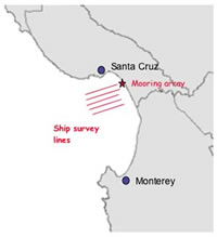
The ship will move along the grid starting
in the northeast corner of Montery Bay |
The scientists aboard the R/V New Horizon will be looking for thin layers of plankton in Monterey Bay. They will look for plankton while the ship is moving around the bay and also when the ship is “on station” in one specific place. Many different instruments will be used to do this.
- While the ship is moving along a grid, the scientists will make a survey or map of the plankton layers. The ship will move along the grid starting in the northeast corner of the bay, about 3 kilometers from land. The ship will travel offshore about 30-40 kilometers, and then turn back toward land. Scientists will look for plankton by using two sets of instruments, optical and acoustic.
The optical layer detection method uses light from lasers to find plankton. A LIDAR system is placed on the bow of the ship. The system projects a laser beam downward through the sea surface. The laser light “scatters” off small plankton at various depths below the sea surface. A detector within the LIDAR system collects this reflected light. Each day, a contour map will be made of the plankton layers that are detected by this method.
The acoustic layer detection method uses sound to find plankton. The scientists will use an echosounder system, much like a fishfinder. The system will be suspended over the port (left-side) rail of the ship at a depth of 2 meters. When the sounds sent from the system find zooplankton and fish larvae, the sound is bounced back to the instruments on the ship. The scientists calculate the travel time of this sound in order to estimate the distance between the zooplankton and the ship.
Scientists will also tow a plankton net behind the ship once a day. They will collect samples of zooplankton from approximately 5 meters above the seafloor to the sea surface.
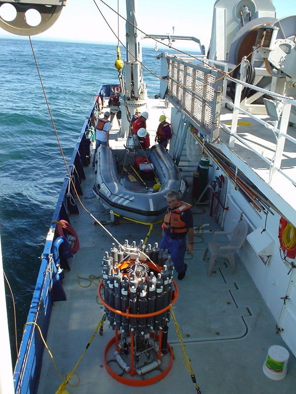
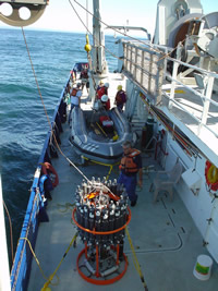
- Scientists will also look for plankton while the ship is “on station”, or stopped at one specific place in the bay. Several times a day, the ship will stop at a place within the grid. CTD/rosette systems will be used to make measurements and take water samples.
CTD from the New Horizon in 2004
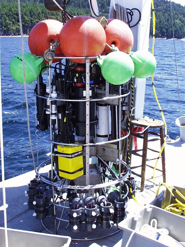
A CTD (Conductivity, Temperature, Depth) rosette will be sent over the starboard (right) side of the ship. It measures the salinity and temperature of the sea water. The instruments will collect water samples from different depths. These samples will be analyzed later in order to measure the amount of nutrients (chemicals), chlorophyll, and carbon in the sea water.
The free-fall profile system will sink through the water from the stern of the ship. Itis attached to a special winch that permits the system to fall through the water at a set speed. This system makes a vertical “profile” or graph of what is in the water. Instruments on the profiler use sound to detect small zooplankton. Other instruments use light to detect phytoplankton. The instruments also measure the temperature, salinity, and oxygen levels of the sea water. |
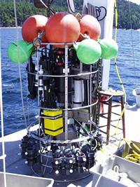
Free-fall profile system
|
This project is funded by the Office of Naval Research, Grant # N00014-01-1-0277 to T.J. Cowles at Oregon State University
|